Access :
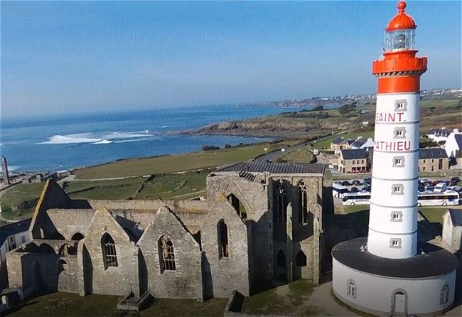
The lighthouse of the Pointe St-Mathieu is located halfway between Plougonvelin and Le Conquet, in the grounds of the abbey, 40 m from the shore. Park in the nearby car park.
This lighthouse, the location of which necessitated the demolition of part of the abbey ruins, seems quite incongruous in such a heritage area. Yet it was built in the 19th century to replace the old fire tower of the abbey, which had the same use, and whose construction probably dates back to the 11th century. When the lighthouse was built, environmental considerations were not then a concern. The main challenge was to ensure the safety of ships in a particularly dangerous sea.
The engineer Antoine-Elie Lamblardie, Director of Maritime Works in Brest, (1784-1842), supervised the work under the authority of the Arago-Fresnel Commission ( Fresnel having died in 1827 ). The lighthouse was lit for the first time on June 15, 1835. It took just four years to build.
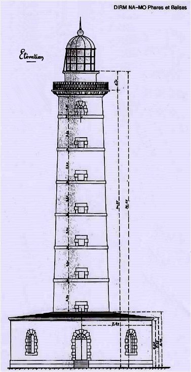
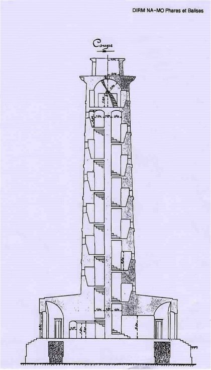 Archives DIRM NAMO - Phares et Balises |
At that time, it was equipped with concentric wick lamps powered by pressurized rapeseed oil. Each flame was capped by a small sheet metal pipe that allowed the draught to be regulated. From the outset, , the lantern was equipped with the first Fresnel step lenses in order to concentrate the light.
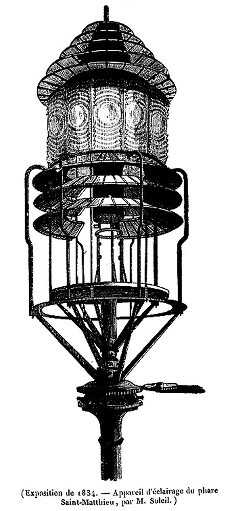
Drawing by the engineer Soleil published in Le magasin pittoresque
It was only after 1843 that it received the even more powerful prismatic lenses that made Augustin Fresnel world famous. In 1874, the oil lamps were replaced by burners using a mixture of air and vaporized petroleum. It is interesting to read the 1920s service chart posted at the entrance. It should be noted that switching on and off of the headlight was planned with extreme precision.
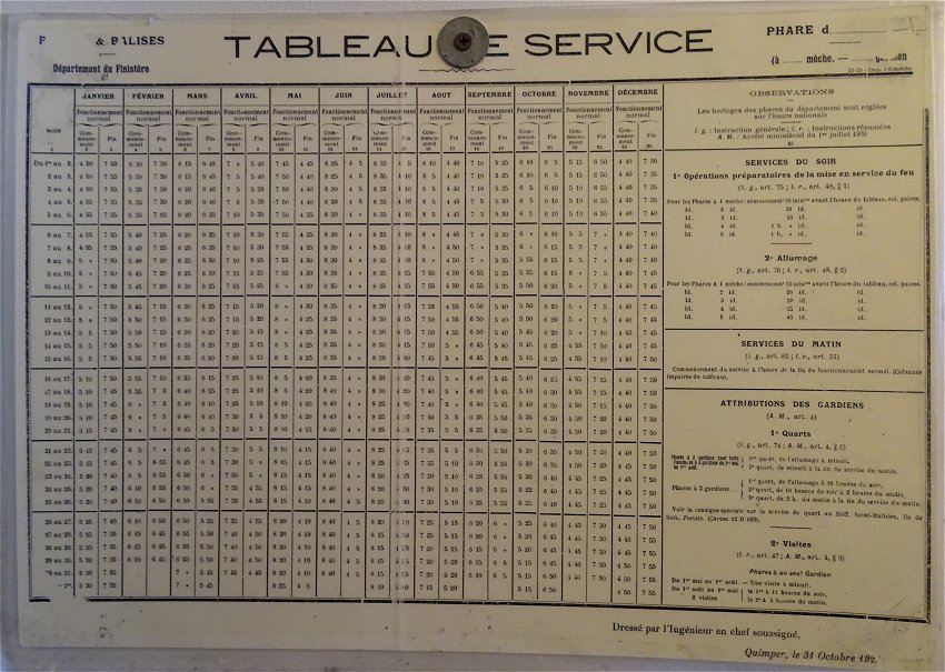
The lighthouse was finally electrified in 1932 and automated in 1996. Since 2005, it has been remotely controlled from Ushant Island. As for the three lighthouse keepers, they were not provided with accommodation in the vicinity until 1879. There were 45 of them in total at St-Mathieu. The last of them, Yvon Penland, who retired in 2006, stayed there for 22 years. Lighthouses isolated at sea were called by the keepers hell ; those located on an island were purgatory. Such a location on the mainland was considered a paradise.
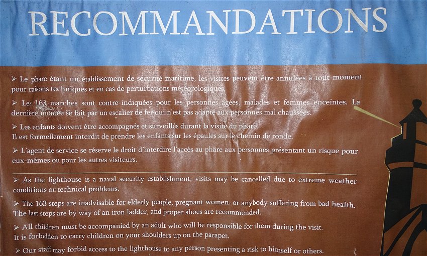
Upon entry, the visitor is informed of the safety recommendations.
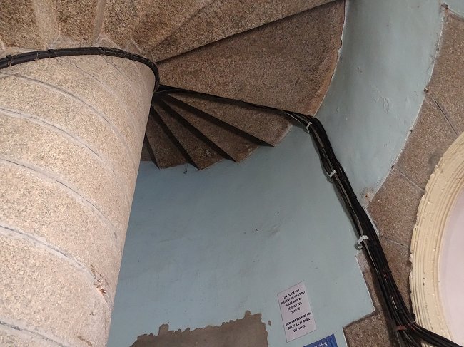
The covered way is reached by a spiral staircase made of Aber Ildut granite, with 163 steps carefully built, one above the other to form a central pillar. It is illuminated by a series of windows that allow visitors to take a short break while enjoying the breathtaking view.
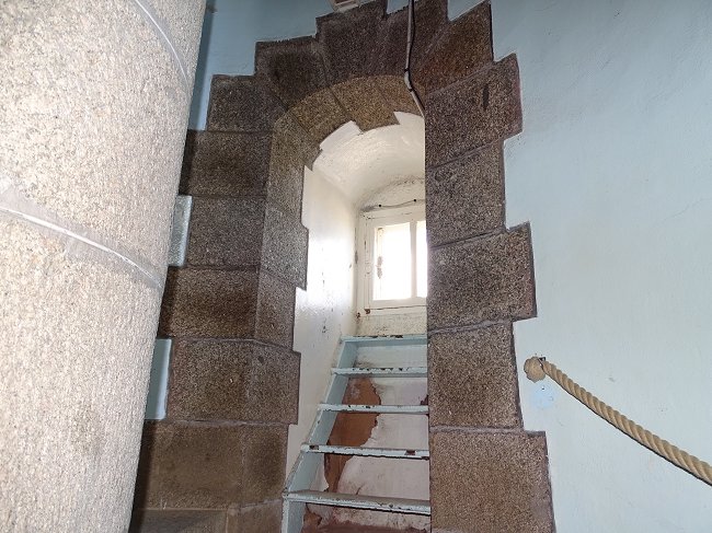
There is a metal staircase after the stone one leading to a panelled room at the top, where the old rotation mechanism of the optics can be seen behind bars.
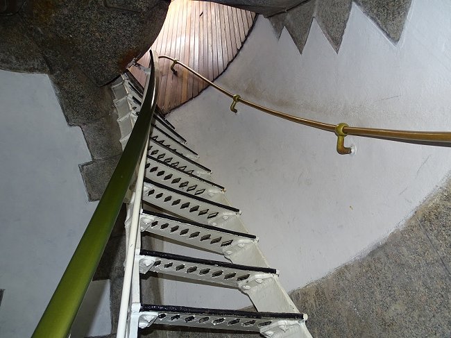
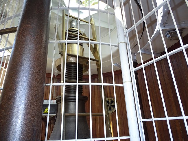
Inside this area, which is off-limits to the public, a ladder leads to the triangular hatch through which the lantern is maintained.
When you reach the covered way, the efforts you made on the way up are finally rewarded with a magnificent view.
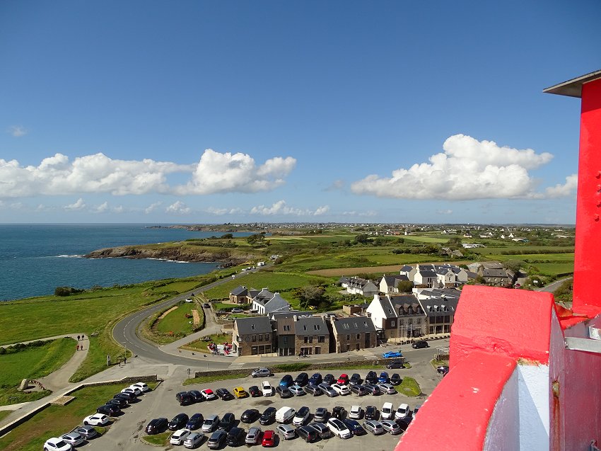
The coastalroad to Le Conquet
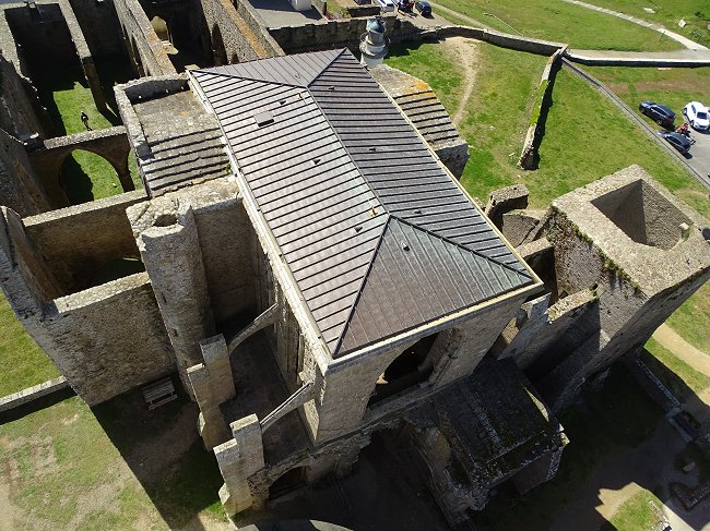
The ruins of the abbey church
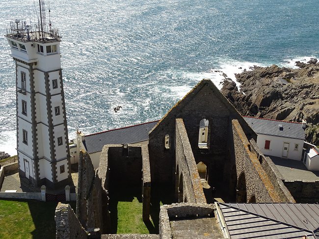
The semaphore and the old entrance to the abbey church
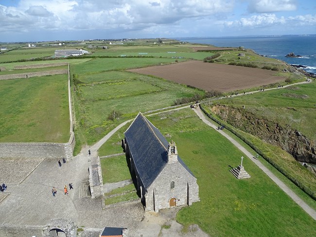
The Chapel of Our Lady of Grace
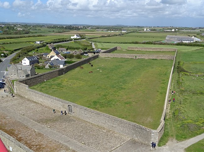
The monks' enclosure
The main light of the lantern
The lantern stands above the covered way. You can see the prismatic Fresnel lens.
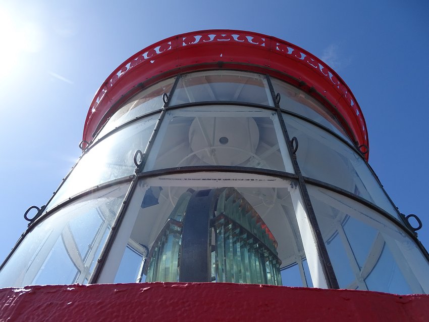
The lighthouse has a range of 24 miles, or 44 km. Emitted through a rotating lens, its white glow appears every 15 seconds. However, its light only comes from a mere 254-watt bulb.
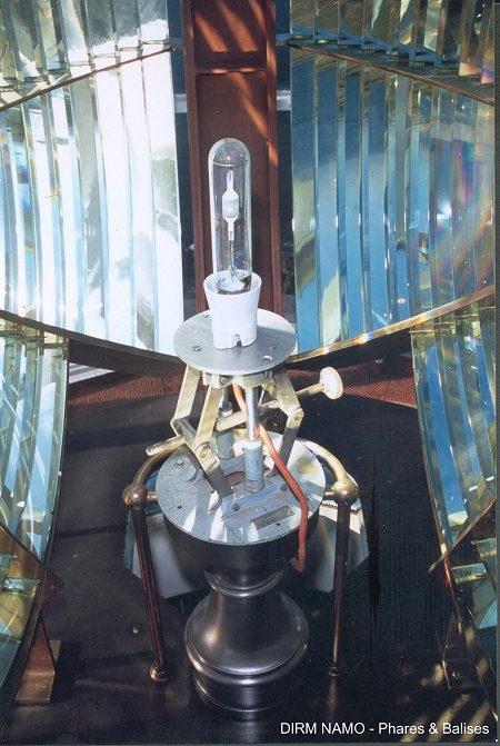
The lighthouse bulb.
It is precisely placed at the focus of the optical assembly
©Photo DIRM NAMO - Phares et Balises
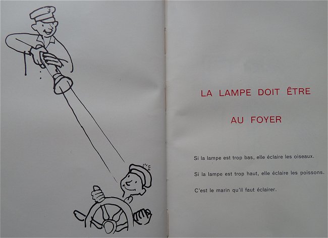
In the past, in a humorous way, the instructions specified to the lighthouse keeper
to scrupulously watch over the correct location of the lamp
(Short manual of lighthouse officers - Phares et Balises 1960)
Reflectors were even installed to lower towards the sea the light rays that could interfere with air traffic.
Rotation of the light beam
Today, an electric motor turns the heavy glass optics as soon as the lighthouse is switched on. This was obviously not the case before the electrification of lighthouses. The light source used to be a pressurized kerosene lamp device or a kerosene or rapeseed oil vapor incandescent mantle. In the event of a breakdown, the guards could use an unpressurized kerosene lamp with a chimney, known as the Aladdin lamp. But the lighthouse's range and brightness were considerably reduced.
The energy ensuring the rotation of the optics was obtained, as in the clocks of our ancestors, by the fall of a heavy cast iron weight. When it touched the ground, which happened several times each night, a bell would ring and the guards would have to pull the weight up by hand1.
The mercury tank
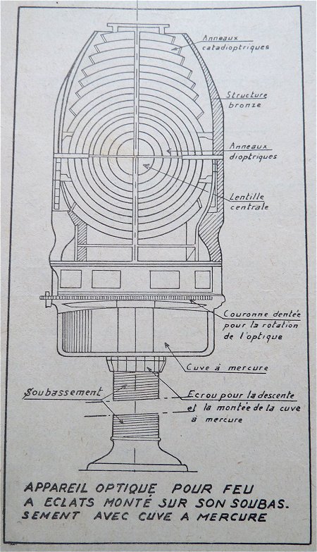
( Manual of the electromechanic and the lighthouse keeper - Phares et Balises 1956 )
To reduce friction, the rotating optical assembly rests on a fixed circular mercury tank. Liquid at room temperature, mercury is a metal with a very high density. The plate supporting the optics does not sink into it but floats on its surface as if on a large ball bearing. When a slowdown in rotation is detected, the Phares et Balises staff must drain, clean thoroughly, and refill the mercury tank within a day. As this metal is particularly corrosive and toxic, this delicate operation is not without risks.
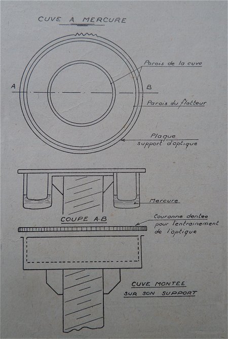
( Manual of the electromechanic and the lighthouse keeper - Phares et Balises 1956 )
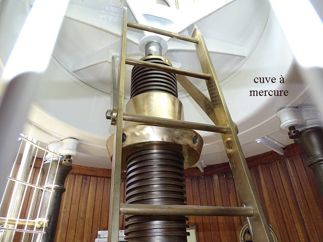
In the room we passed through at the end of the climb,
we can see the mercury tank underside.
Schedules, rates, reservations :
Cliquez ICI
Auxiliary lights
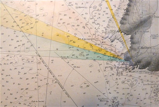
Old chart edited by the SHOM and exposed on the ground floor
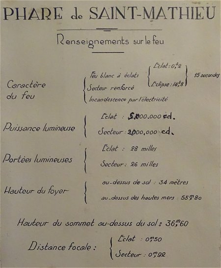
The unit indicated for the luminous power is the candela
A white beam ( in yellow on the map below ), fixed, is emitted in the lantern by a led of 35 watts. With a range of 28 miles and directed towards the lighthouse of Kermorvan, in Le Conquet, it aims to give the direction of the Four channel
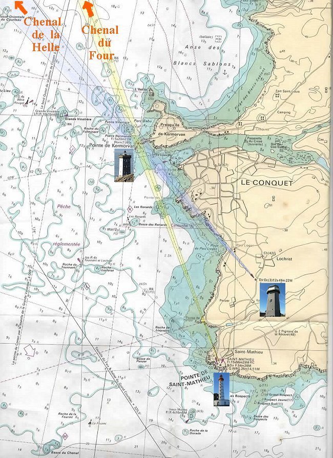
In reality, the directional beams colored here in yellow and blue are white.
From the marine chart 7122P published by SHOM
" De la pointe St-Mathieu au phare du Four "
The Four Channel is the navigable part of the Iroise Sea located between the coast and the island of Beniguet. It extends to the English Channel in a part of the sea that presents many dangers: a powerful current that reverses with the tide, a hundred or so reefs responsible for numerous shipwrecks, not to mention the sometimes violent gale force wind that sailors have always feared. Since ancient times, ships have always followed the Four Channel to the English Channel and the North Sea. Compared to the sea route beyond the islands, this route saved them precious time. Hence the need to secure it. Shortening the route to the Channel, it has known an intense traffic before the establishment of the Ushant rail beyond the islands. Today, only fishing and sailing boats, Navy ships, island shuttles and some ferries are allowed to use the Four Channel.
The Molène archipelago is not parallel to the coast, so another channel, the one of La Helle, is heading there. It is indicated by the alignment of the
Lochrist light
with the lighthouse of Kermorvan ( blue beam on the map ).
A small lighthouse on the abbey grounds can be seen from the covered way. Its white lantern has a green and red protrusion.
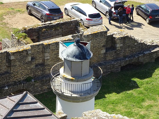
This is a second auxiliary light designed to allow navigators coming from the Four channel to change course at the color change to bypass the Saint-Mathieu point in order to head towards Brest or the Pointe du Raz2.
It contains a 90-watt bulb with a range of 8.5 miles in the green and red sectors and 12 miles in the white sector.
The return trip down the steps to ground level does not present any particular difficulty. However, children are always ready to get ahead of the adults at the risk of missing a step... and maybe many others out of the 163 steps.
A thoroughly worthwhile visit for family and friends.
***
1- The weight was made of cast iron washers threaded on a metal rod suspended from a galvanized steel cable about ten meters long. By a system of pulleys, this cable was connected to a speed regulator braking the rotation of the optics. During the night, the guards had to check this rotation speed at least three times and if necessary modify it slightly so that it was exactly the same as the one imposed on them.
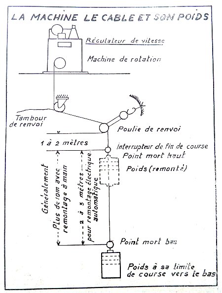
( Manual of the electromechanic and the lighthouse keeper - Phares et Balises 1956 )
2- The role of the lights intended to change direction is explained in the Manual of the electrical engeneer and the lighthouse keeper published by the Phares et Balises :
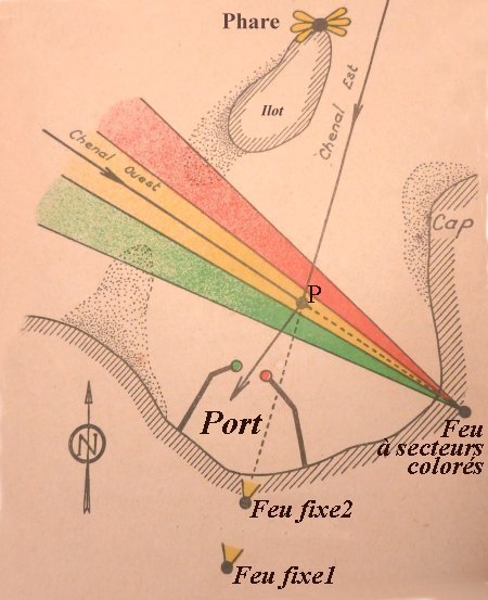
Be careful : to better distinguish them,
the white light beams are colored in yellow
The explanation is simple : A sailor coming from the East Channel and wishing to reach the harbour will leave the lighthouse of the islet to starboard and will align himself with the fixed lights 1 and 2. He will therefore cut the coloured beams. When he sees that the red light changes to white, he will be at point P and will change course to pass between the green and red lights of the harbour.
If coming from the west, leaving the island light to port, the vessel will proceed within the white beam of the coloured sectors light and change course at point P when it sees that fixed lights 1 and 2 are aligned.
In the Iroise Sea, whether you are coming from the north through the Four channel or from the south-east after leaving Brest, you also change course when the colour changes.
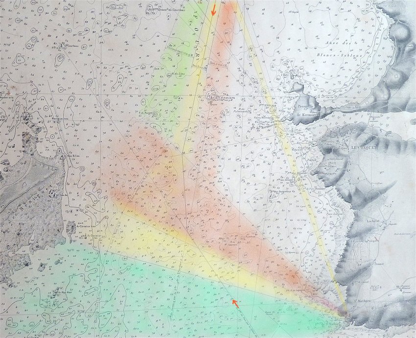
Fragment of the SHOM 1964 chart From the Pointe de Saint-Mathieu to the island of Molène
colored by us
Thanks to Jean-Yves Le Bars, former keeper of the lighthouse, for his help and the loan of his documents.
Thanks also to Glyn Orpwood who reread this text and modified the English version.


