


Access :
The Lochrist light is located inland, 600 m from the shore. It can be reached from via the D 789, from Brest to Le Conquet. Follow the small signposted road "Lochrist" to the west near the Lannou roundabout. You can also reach it via the coastal road between La Pointe St-Mathieu and Le Conquet by following the signs to the village of Lochrist, opposite Porsliogan beach. Cross this village and continue towards St-Mathieu. Parking nearby.
Lighthouse or "light"? What is the difference ?
Generally speaking, for sailors, a light refers to any marine signal light. For example, it is said that a fire shines on top of a lighthouse.
But the names lighthouse and light designate different "maritime signalling establishments" according to their official names.
To qualify for the lighthouse name, they must meet at least 2 of the following 4 criteria :
-
Have a wide coverage1 or a large sea route coverage.
-
The height of the focal plane of its light with respect to the base of the building must be at least 20 meters.
-
With the visibility of 10 miles, its range must be at least 20 miles.
-
Its enclosure includes one or more out-buildings designed for security and access.
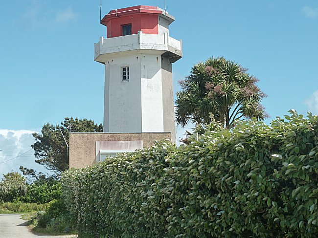
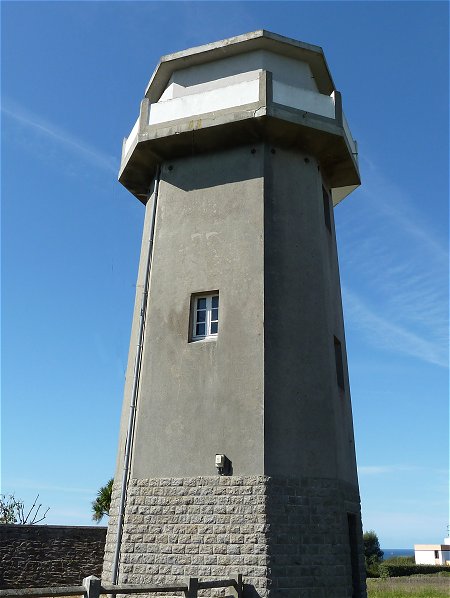
At Lochrist, only its 23-mile range meets these criteria. it cannot be described as a lighthouse, but simply a light.
The total height of the octagonal building is 18 m. The turret on its top is two-tone : white on the land side, red on the sea side.
An observation platform has been built around the turret, allowing non-disabled visitors a 360° panoramic view of the area.
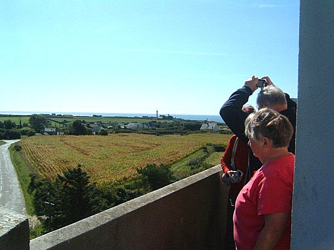
In the distance, the Pointe St-Mathieu lighthouse is in clear view.
The bulb and Fresnel lens are visible through an opening in the masonry. The light is white, occulted ( 2+1) every 15 seconds. By aligning it with the Kermorvan lighthouse, it allows sailors to determine the direction of the Helle channel, shown in blue on the map, which connects the Four channel to the Fromveur channel, and therefore to Ouessant, at a heading of 137.9 toward the Stiff lighthouse.
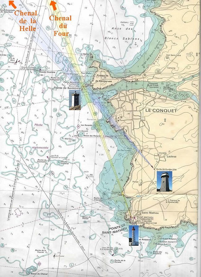
In reality, the directional beams
which we have coloured yellow and blue here, are white.
From the marine chart 7122P published by SHOM
" De la pointe St-Mathieu au phare du Four "
Bathymetric surveys have shown that this channel is in fact the remnants of the underwater extension of the Ria du Conquet, whose estuary was located 26,000 years ago off Molène. 2
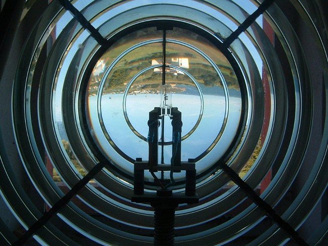
A Fresnel lens is made up of several elements that give an inverted image, such as a photographic lens.
This one concentrates the light provided by the small bulb so much that its range is 42.6 km !
-1-
The word " atterrissage " is an important distinction from the maritime term "atterrage" which simply means an area from which the coastline can be seen. An "atterrissage" zone is defined as the area from which the coastline can be identified.
A maritime establishment is said to have a " grand atterrissage " when it is close to a change of course, i.e. a turning point in the maritime route, such as the Saint-Mathieu lighthouse or the Créac'h lighthouse on Ushant.
-2-
Martial Caroff and Bernard Le Gall: Curiosités géologiques du Léon, de l'ile d'Ouessant à l'île de Batz. Editions Apogée / BRGM editions, 2013.
Thanks to Glyn Orpwood who reread this text and modified the English version.