


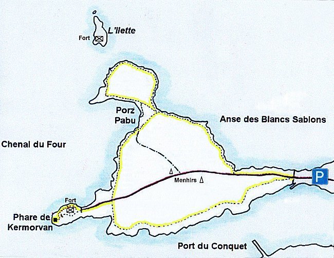
The Kermorvan peninsula is one of the main jewels of the Iroise Country. It boasts an immense beach overlooking a splendid bay, a long walk on a steep path winding over a wild coastline, an isolated islet ( a romantic headland cut off at high tide and crown with a 19th century fort ), an emblematic lighthouse at the far end of a rocky point and an unobstructed view of an active port that extends into a magnificent estuary. Owned by the Conservatoire du Littoral, the entire peninsula is now protected and maintained by the 'Iroise Communauté'.
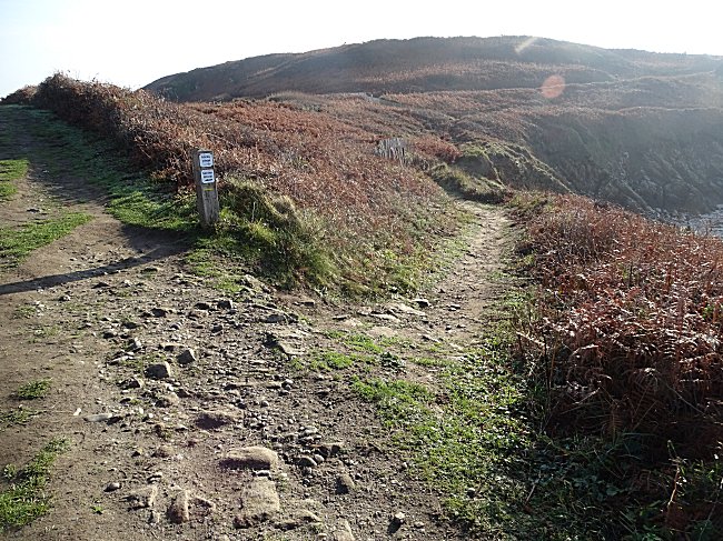
The full walking tour takes about an hour and a half and is well worth it : the path is sometimes narrow with rocky outcrops, however there are steps to climb the steepest slopes. The hilly path is a must for joggers and walkers alike. If you are not too sure of your balance, bring hiking poles, especially if the ground is a little wet.
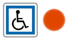
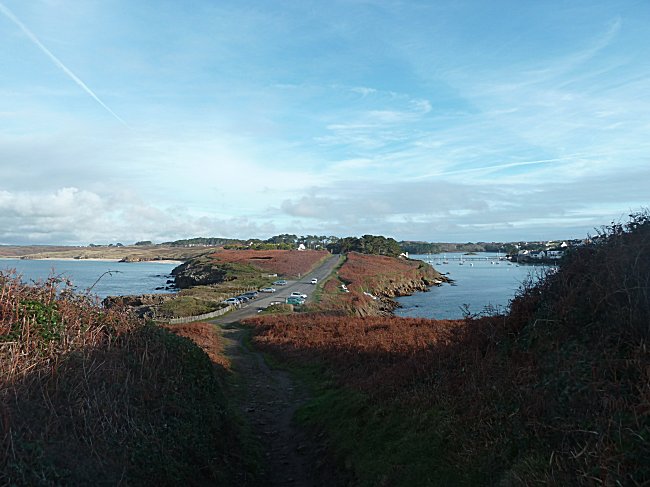
Strollers and wheelchairs : keep to the small paved road. The lighthouse is 1 km and although not open to the public, is easily visible.
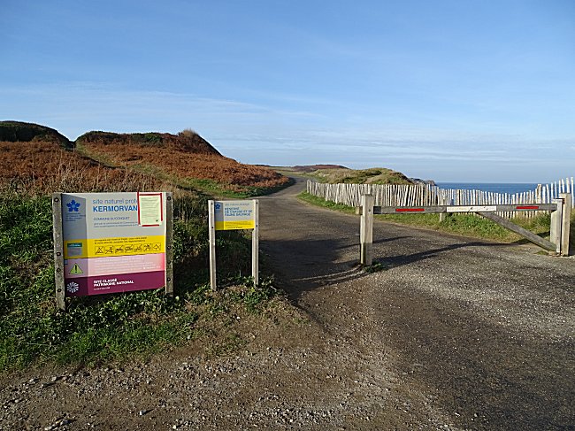
Access :
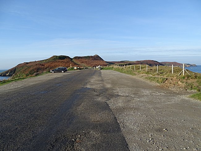
Coming from Brest or Le Conquet, take the road between the inner port of Le Conquet and the Kerjan lake, direction St-Renan, Plouarzel. Turn left at the first crossroads towards Ploumoguer-Plouarzel. At the next crossroads, turn left towards the Kermorvan peninsula and the Blancs Sablons beach. Parking in the isthmus at the end of the road.
You are at the narrowest point of a long peninsula that separates the Ria of Le Conquet from the bay of the Blancs Sablons and the Iroise Sea. On both sides the view is superb. The port and the houses of Le Conquet lie to the south, while to the north the large beach of Blancs Sablons extends for more than two kilometres.
Cross the barrier and walk along the small asphalt road.
As you pass by, you can observe the remains of fortifications. The peninsula has always been a strategic place and has been the case since prehistoric times, when it was already a remarkable barred spur.
Megaliths further testify to an occupation in the Neolithic period.
The proximity of a port and the defence of a long beach where the enemy could land have made it an essential place for coastal defence at all times in history, as well as a ready-made training ground for the military.
150 m from the car park, take the coastal path via the wide flight of steps on the right that lead down.
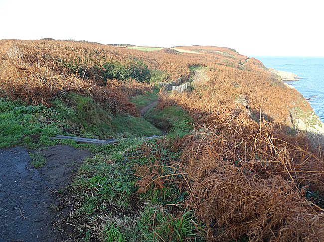
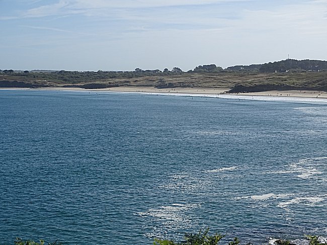
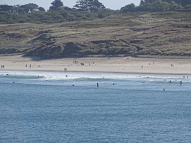
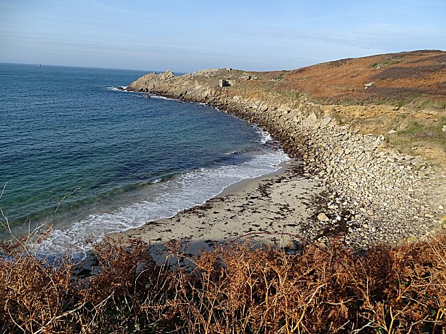
Follow the eastern side of the peninsula. On the right is the long beach of Blancs Sablons, which is divided into four parts by three rocky spurs at high tide. It is the meeting place for lovers of all kinds of water sports and paragliding. It is also a prized destination for the many beach goers and bathers from Brest during the weekend and holiday periods.
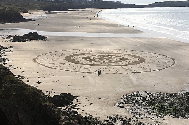
Sand engraving on the Blancs Sablons. April 7, 2019 © P.L.
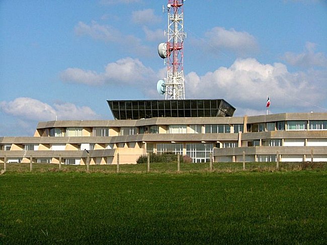
In the distance you can see the windfarm of Ploumoguer, its beaches and the Corsen headland in the municipality of Plouarzel, where the buildings of the CROSS (Centre Régional Opérationnel de Surveillance et de Sauvetage) are situated. This centre for maritime operations co-ordinates not only rescue missions and early warning pollution monitoring but also controls the traffic in the busy shipping lanes that divide the Atlantic Ocean from the English Channel covering all of the Atlantic Arc.
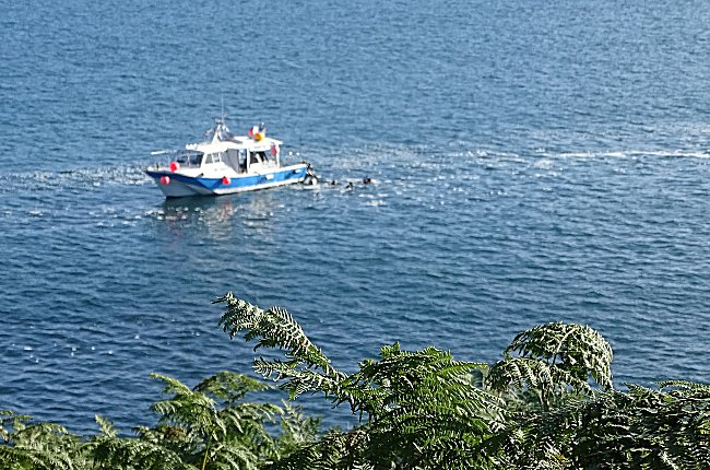
Below the trail, the isolated rocks are the resting place for seagulls and cormorants. Further on, there is a delightfully sheltered cove on the coast, you may see off-shore the Diving Club boat of Le Conquet where both experienced divers and new comers enjoy the remarkably clear water.
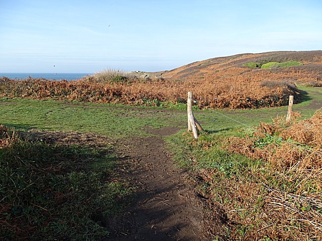
The path then leads to a crossroad. The shorter route takes a left turn and then right to reach the lighthouse. But that would be depriving yourself of the most beautiful part of this itinerary. Instead, continue along the coast to the right. You'll come back here later.
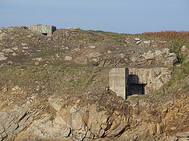
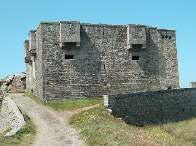
You soon arrive at a small promontory that boasts a magnificent view of the Ilette, dominated by its fort. This pretty name of the Ilette is in fact the phonetic pronunciation of its former name, Ilet, where the final T would not normally be prononced in French. However, Ilet originally was the French interpretation of its Breton name Lined. Fishermen refer to the northern headland of this islet as Korn Lined.
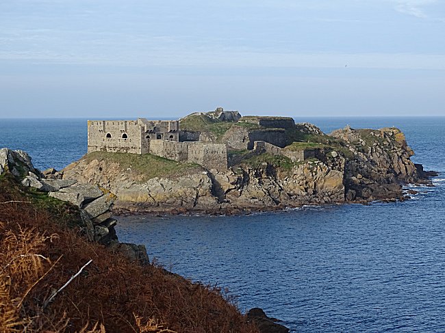
The fort was constructed as part of the fortifications erected along the coast line in the middle of the 19th century.
The path leads us to examine this fort more closely.
 |
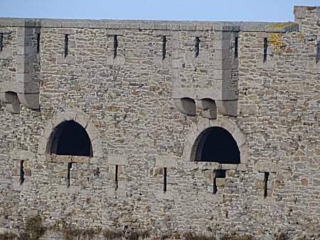 |
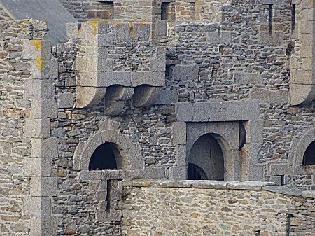
It is a crenelated guard corps, type n°2 of 1847, intended to defend the passage to the bay of Brest as well as to prevent any landing in thebay of Blancs Sablons. Colonial disputes with England led King Louis-Philippe to build defences over the entire area as a matter of priority. The work continued until 1852, regardless of the political changes that France underwent during that time. We can guess the difficulties associated with this site, which could only be supplied at high tide and in calm weather by shallow-draught boats.
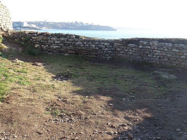
This fortification included a permanent garrison that had several stores ( gun powder, food and military ), a cistern, and housing for its personnel under the artillery terrace. A drawbridge defended the entrance and one can still see the projecting gate houses, the wide openings for the guns and the battlements which, like medieval archways, are set in two rows covering the entire wall.
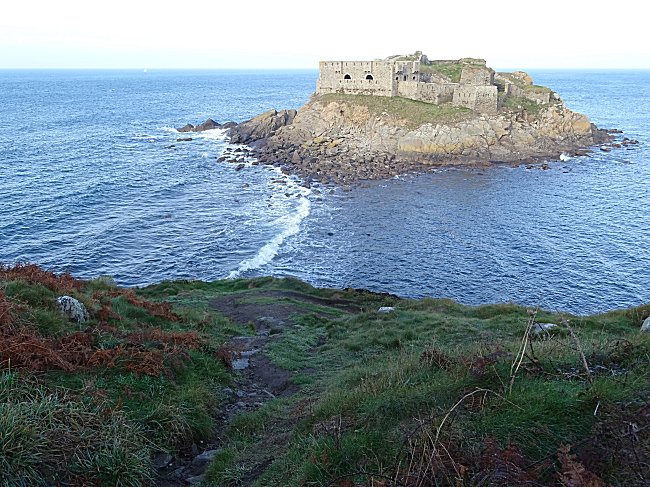
Access is only possible on foot at low tide . However, the passage is difficult because the causeway separating this islet from the mainland is made up of large rocks covered with slippery seeweed and the time allocated to the visitor is reduced because of the rising tide.
Tide times today, click on the following link : SHOM
Leaving Ilette behind, continue on the path heading south. In the distance, the headland of Kermorvan and its lighthouse are soon visible.
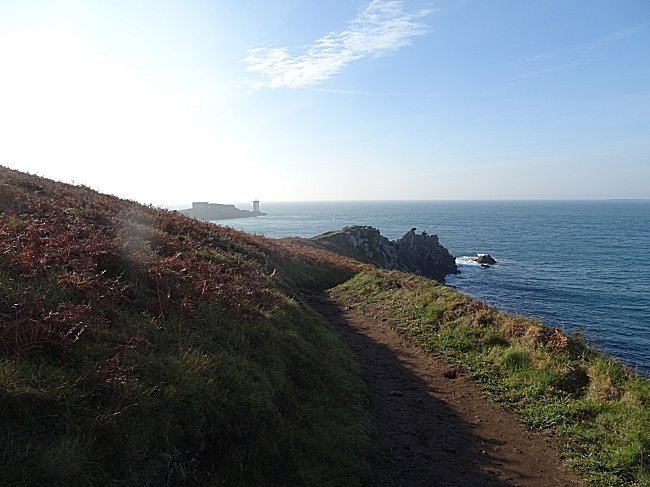
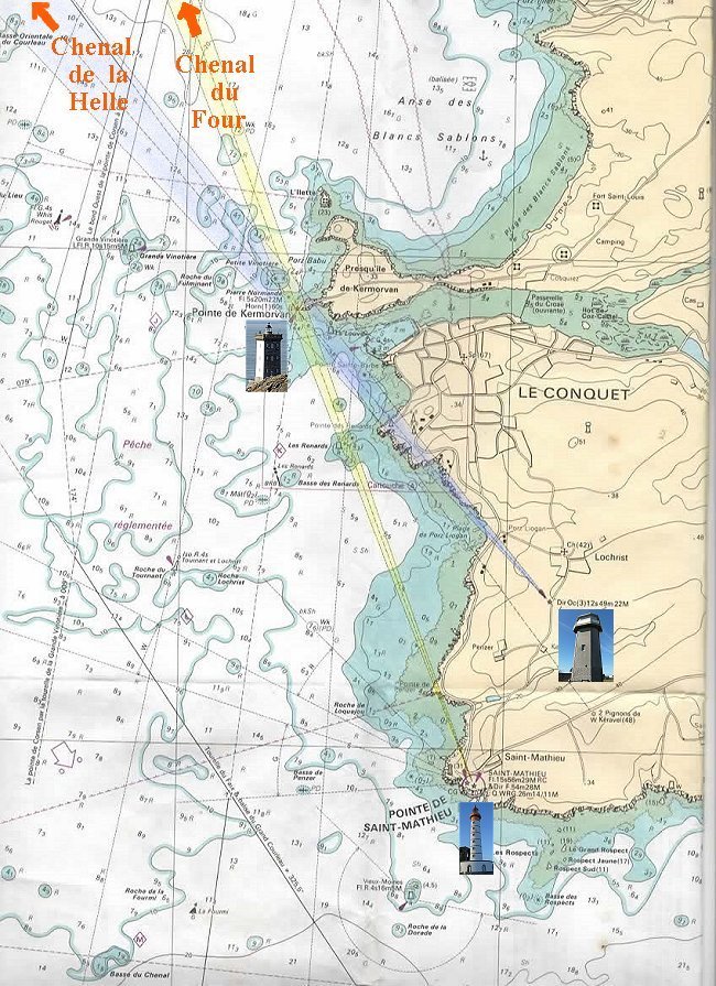
The path now runs along the west face of the peninsula. Looking out to sea you can observe the islands of Béniguet, Litiry and Quéménès, this stretch of the Iroise Sea is called the Four Channel. Further on, in the direction of Molène and Ouessant ( Ushant ), is the channel of La Helle. Until the oil spill of 1978, caused by the sinking of the Amoco Cadiz, much of the intense navigation around the Breton headland was carried out via this shortcut. It is now mandatory to use the Ushant shipping lines behind the islands. The channels of the Four and the Helle are reserved for fishing and pleasure boats, the French Navy and, under certain conditions Brittany Ferries.
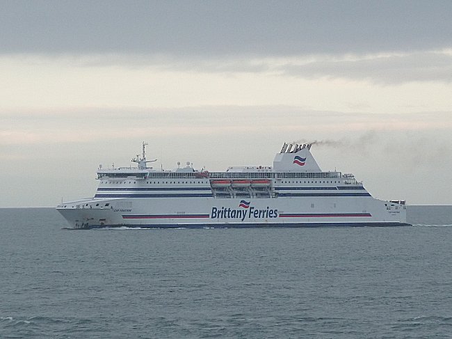
On the way to Bilbao, the ferry Cap Finistère navigates past the Kermorvan peninsula
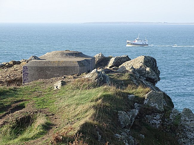
You pass by one of the many tobruks or ringstand bunkers that the German occupier built along the coast during the Second World War. This type of individual concrete bunker was discreet and concealed a lookout armed with an MG-34 machine gun.
On the right, a path leads directly to Porz Pabu beach. Saint Pabu is the familiar name of Saint Tugdual1, a Welsh monk who reportedly landed on this beach in the 6th century to evangelize the population. This saint is one of the 7 main saints of Brittany and is the patron saint of the church in the neighbouring commune of Trébabu.
Let's continue on the wide upper path. We arrive at the crossroad of paths seen earlier. Turn right and go down the GR-34 which runs along the beach of Porz Pabu whose access by sea fell during the war under the fire of two craftily buried bunkers.
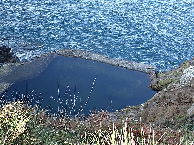
Not far from the Kermorvan lighthouse, you can see a water reservoir below the coastal path closed off by a low wall. In Le Conquet, it is known as the German pool. Although the name is undoubtedly well founded, it was simply a freshwater reservoir fed by a spring from the cliff before the Occupation. The place is originally named after the Breton phrase Aod ar Feunteun ( the fountain coast ) and must have been used not only by the lighthouse keepers, but also by the many sailboats looking for an easily accessible source to replenish their supplies of fresh water. However, after a storm and high tide, the pool was certainly contaminated by sea water...
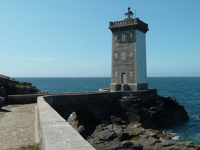
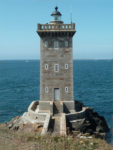
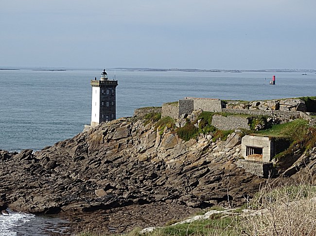
The fort and the lighthouse of Kermorvan are on the right. The lighthouse itself is only open to visitors during the tourist season. But you can go and have a look around. Let's go through its enclosure.
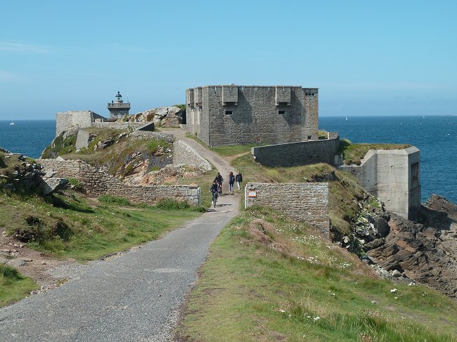
One is first struck by the resemblance between the fort of Kermorvan and that of Ilette. They are indeed part of the same family. The one in Kermorvan is a type 2 guard house from 1846. Strategically well located, it controlled both the Four Channel and the entrance to the port of Le Conquet.
At the foot of the fort, take the path on the right that leads to the north of the fort. Then continue straight on, keeping the sea on the right. A paved path suddenly gives us a magnificent view of the lighthouse.
You can see that a bridge was built to access it. At this point, a series of rings on one side of the parapet and two old metal bars on the other will be noticed.
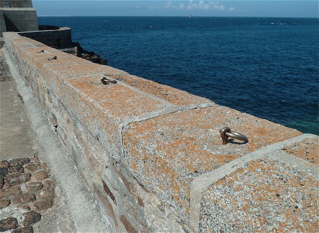
You have to imagine the seas crashing against this bridge on stormy days. In order to allow access to the lighthouse in relative safety in the past, it was possible to hang on to the bars or to a rope attached to the rings. It is no longer necessary today, there are no more guards, the lighthouse is remote controlled.
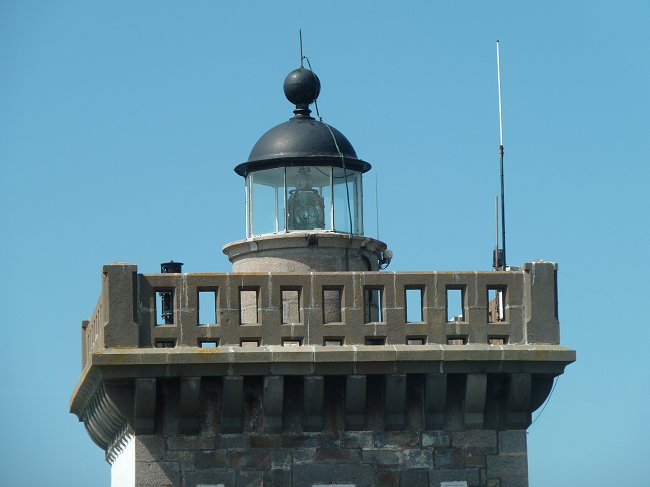
Ideally located at the extreme headland of the peninsula, Kermorvan is the most western land lighthouse in France. Commissioned in 1849 and with a total height of 20.35 m, it indicates the direction of the Four Channel when aligned with St-Mathieu's lighthouse and the Helle Channel when aligned with Lochrist light house.
In reality, the beams colored here in yellow and blue are white.
From the marine chart 7122P published by SHOM
" De la pointe St-Mathieu au phare du Four "
Remotely controlled from Ushant, its white glow every 5 seconds extends up to 22 miles, or more than 40 km.
More information about Kermorvan Lighthouse:
The lighthouse of Kermorvan
On the way back to the fort, you can see a deep cavity dug into the ground and protected by a low wall. It is an access to the three bunkers of this point in order to supply them with ammunition during the Occupation. The underground tunnels are currently walled off.
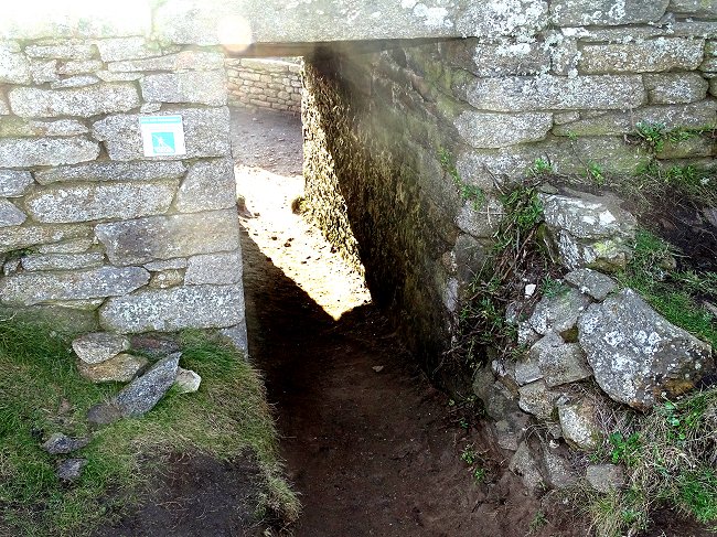
You can then turn right and follow the main driveway to the former artillery terrace of the fort. It is reached by a small passage of 5 to 6 m length where you may have to lower your head.
But it is from this terrace that you have the best view to the lighthouse.
From the top of the lighthouse, 24 hours a day, a 360° view :
webcam
At the end of the lighthouse enclosure, you can shorten the route and return directly to the car park by taking the small road that runs alongside two of the last menhirs.
Les derniers menhirs de Kermorvan
However, to complete the full circuit continue along the coastal path, you can see the German bunker whose gun controlled the entire southern part of the channel as well as the entrance to the port.
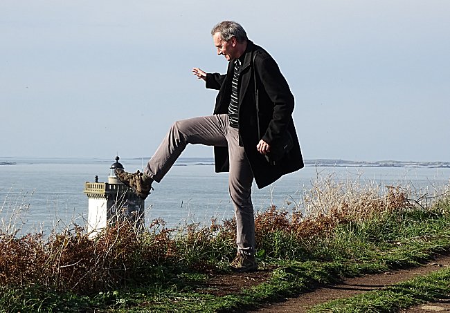
And you will probably also have fun taking pictures of the Kermorvan lighthouse from unusual angles. 2.
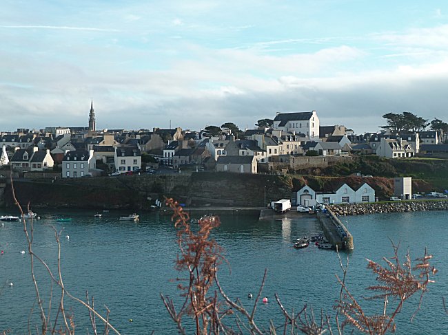
You then follow the south face of the peninsula back to the carpark. Admire one of the prettiest views of the port and the town.
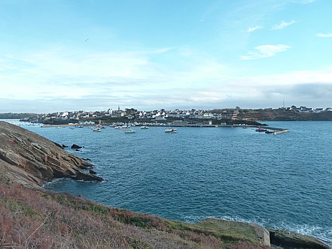
The path continues on, giving a panoramic view of the town nestled above the port, the pier and the quays.
We finally reach the parking spot. From there, megalith lovers can continue their discoveries by following our page dedicated to the last menhirs of Kermorvan.
And if you see a paraglider flying silently over the beach and the Ria, swinging its multicoloured wing from one bank to the other, don't hesitate to speak to the pilot when the glider is on the ground. He or she will probably tell you that, seen from the sky, this peninsula is so beautiful that he or she now knows why birds sing…
Thanks to Glyn Orpwood who reread this text and modified the English version.
***
-1-
Read in French on the web the page entitled Saint Tugdual written by Jean-Pierre Clochon, historian of Le Conquet.
He relates the arrival of Saint Tugdual and explains the origin of his nickname Saint Pabu.
-2-
Any original pictures that you took on the Kermorvan trail would be most welcome. We can add them to our website section. Please send by them by email including written permission of the any person in the picture.
